
Lakeview Hideaway
Markets & Groceries
Foodland - Buckhorn
3329 Buckhorn RdBest place to get your everyday needs
Remedy'sRx - Buckhorn Pharmacy
1911 Lakehurst RdBuckhorn General Store
1908 Lakehurst RdMcLean Berry Farm
2191 16 LineLockside Trading Co
2805 River AveFishing and Boating
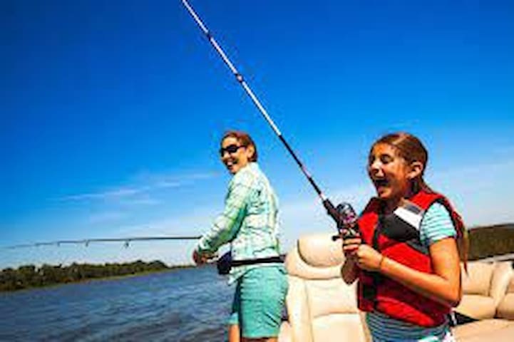
Three Castles
3355 Buckhorn RoadDocking, fishing and boat rentals.
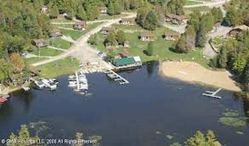
Catalina Bay Resort
17 Fire Route 82BResort getaway with boat launching and docking.
Cadigan's Camp & Cottages
305 Cadigan Road20 acres on the border of Pigeon and Buckhorn lake.
Kawartha Highlands Provincial Park
106 Monck StCanoeing, Kayaking, portaging, and day trips.
Buckhorn Canoe Company
Egan Houseboat Rentals
23 Lila CourtCruise the Trent Waterway in a houseboat rental.

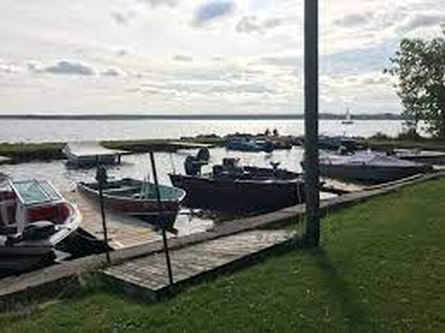
Town & Country Marine
2983 Buckhorn RoadParis Marine Ltd
2980 Lakefield Rd
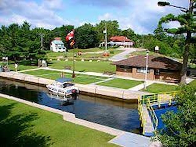
Scotsman Point Resort
467 Six Foot Bay RoadBuckhorn Yacht Harbour
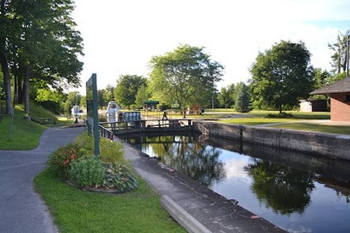
14 Fire Route 25Liftlock & the Riverboat Crisis
92 George St NCity/town information
John Hall, the first settler in this area, constructed a dam and sawmill here in 1830. A grist-mill, added later, was removed in 1883 during the construction of the Buckhorn locks. These millstones were recovered from rubble near the site of the grist-mill. Erected in 1993 by The Greater Harvey Historical Society in co-operation with the Trent-Severn Waterway.
Did You Know?
That, the Mississauga Indian along with a number of other tribes used the lakes and streams in the area as a means of transportation and a source for food through fishing. The 20′ high rock, located near the bridge on the shores of Buckhorn rapids, known as “Council Rock” is believed to be the site of Indian Council meetings.
That, in 1839, Buckhorn’s population was 50.
That, lumbering was a chief export industry with a number of mills built in the area producing squared timbers, ship’s masts, shingles, barrels etc. These products were transported via the inland waterways to Quebec for shipment to Great Britain and Europe. A large portion was also shipped down the Erie Canal (opened in 1825) to New York.
That, there is an historical plaque between Lock31 and the dam honouring John Hall, the first settler of this area (1827), who constructed a dam and sawmill there in 1830. Two millstones, recovered from the rubble near the site of the original mill, are on display.
Look for the stone with the square hole. It moved while the other remained stationary during the grinding of grains into flour.
That, John Hall became the first postmaster, and for matters of the Royal Mail, the settlement was named “Hall’s Bridge”. However, John Hall’s collection of deer antlers, which he displayed on the outside walls of his mills, which gave rise to the name Buckhorn. It wasn’t until 1936 the hamlet became officially recognized as by its present name.
That, John Hall died in1883 at the age of 96 years, but not before he gave every female in Hall’s Bridge (Buckhorn) a plot of land to build a home in order to encourage the continuing growth of the hamlet.
That, Harvey Township (Ward) was named after Sir John Harvey who gained notoriety in the War of 1812 and later became the Governer of New Brunswick, Nova Scotia & Newfoundland.
That, a little way down Adam & Eve Road, on the north side, you will see 2 large glacial rocks. Folklore has it that if a young couple can hold hands and each touch one of the rocks, their lives will be blessed.
That, folklore tells a story about beautiful Sandy Lake, also known as “Lake of Spirits”. In the south bay, visible from Lakehurst Road is a large, heart shaped rock known as the “Giants Heart”. There on calm days, ripples form over the rock formation, causing it to look as though the “Heart” is beating. This lake is land locked and has no feeder river. But water flows out of the lake and down Sandy Creek to Buckhorn Lake. Where does this water come from?
33 lokale anbefaler
Buckhorn
John Hall, the first settler in this area, constructed a dam and sawmill here in 1830. A grist-mill, added later, was removed in 1883 during the construction of the Buckhorn locks. These millstones were recovered from rubble near the site of the grist-mill. Erected in 1993 by The Greater Harvey Historical Society in co-operation with the Trent-Severn Waterway.
Did You Know?
That, the Mississauga Indian along with a number of other tribes used the lakes and streams in the area as a means of transportation and a source for food through fishing. The 20′ high rock, located near the bridge on the shores of Buckhorn rapids, known as “Council Rock” is believed to be the site of Indian Council meetings.
That, in 1839, Buckhorn’s population was 50.
That, lumbering was a chief export industry with a number of mills built in the area producing squared timbers, ship’s masts, shingles, barrels etc. These products were transported via the inland waterways to Quebec for shipment to Great Britain and Europe. A large portion was also shipped down the Erie Canal (opened in 1825) to New York.
That, there is an historical plaque between Lock31 and the dam honouring John Hall, the first settler of this area (1827), who constructed a dam and sawmill there in 1830. Two millstones, recovered from the rubble near the site of the original mill, are on display.
Look for the stone with the square hole. It moved while the other remained stationary during the grinding of grains into flour.
That, John Hall became the first postmaster, and for matters of the Royal Mail, the settlement was named “Hall’s Bridge”. However, John Hall’s collection of deer antlers, which he displayed on the outside walls of his mills, which gave rise to the name Buckhorn. It wasn’t until 1936 the hamlet became officially recognized as by its present name.
That, John Hall died in1883 at the age of 96 years, but not before he gave every female in Hall’s Bridge (Buckhorn) a plot of land to build a home in order to encourage the continuing growth of the hamlet.
That, Harvey Township (Ward) was named after Sir John Harvey who gained notoriety in the War of 1812 and later became the Governer of New Brunswick, Nova Scotia & Newfoundland.
That, a little way down Adam & Eve Road, on the north side, you will see 2 large glacial rocks. Folklore has it that if a young couple can hold hands and each touch one of the rocks, their lives will be blessed.
That, folklore tells a story about beautiful Sandy Lake, also known as “Lake of Spirits”. In the south bay, visible from Lakehurst Road is a large, heart shaped rock known as the “Giants Heart”. There on calm days, ripples form over the rock formation, causing it to look as though the “Heart” is beating. This lake is land locked and has no feeder river. But water flows out of the lake and down Sandy Creek to Buckhorn Lake. Where does this water come from?
Ennismore
Lakefield, Ontario is a beautiful little town nestled in the Kawartha Lakes region of Ontario. Just a short two hour drive from Toronto (and a mere ten minutes from Peterborough), Lakefield is best know as a community that typifies small town Ontario. It’s a historic little town and the business section is lined with quaint shops, perfect for a weekend of antique hunting.
The town features waterfront parks, restaurants and the streets boast many charming original homes and churches dating back to the 1800’s. Right on the border of cottage country, visitors to Lakefield can soak in the feeling of both the historic aspects of farm town life and you are only a few steps from the scenic Otonabee River as it meanders through town. The best of both worlds!
When you come to Lakefield take the time to wander the boardwalk along the Otonabee River. You can also hike or bike along miles of rail trail. And because the town is situated in the Trent Canal Waterway system you can even arrive by boat! There are many area attractions including shopping, spa, golf, museums and galleries. It is also interesting for winter sports lovers to note that Lakefield will be the new home of the Ontario Speed Skating Oval expected to be open for the winter of 2006.
11 lokale anbefaler
Lakefield
Lakefield, Ontario is a beautiful little town nestled in the Kawartha Lakes region of Ontario. Just a short two hour drive from Toronto (and a mere ten minutes from Peterborough), Lakefield is best know as a community that typifies small town Ontario. It’s a historic little town and the business section is lined with quaint shops, perfect for a weekend of antique hunting.
The town features waterfront parks, restaurants and the streets boast many charming original homes and churches dating back to the 1800’s. Right on the border of cottage country, visitors to Lakefield can soak in the feeling of both the historic aspects of farm town life and you are only a few steps from the scenic Otonabee River as it meanders through town. The best of both worlds!
When you come to Lakefield take the time to wander the boardwalk along the Otonabee River. You can also hike or bike along miles of rail trail. And because the town is situated in the Trent Canal Waterway system you can even arrive by boat! There are many area attractions including shopping, spa, golf, museums and galleries. It is also interesting for winter sports lovers to note that Lakefield will be the new home of the Ontario Speed Skating Oval expected to be open for the winter of 2006.
The small town of Bancroft, Ontario is nestled in the York River Valley on the southern edge of the Canadian Shield. Bancroft offers many natural wonders to experience. From fishing to snowmobiling to mineral collecting, there is something for everyone, no matter what the season. Downtown boasts many different stores fulfilling all your shopping needs. Come enjoy the heart of North Hastings.
Bancroft, Ontario is a four season's playground attracting visitors throughout the year. Bancroft has many things to offer its tourists and cottagers.
99 lokale anbefaler
Bancroft
The small town of Bancroft, Ontario is nestled in the York River Valley on the southern edge of the Canadian Shield. Bancroft offers many natural wonders to experience. From fishing to snowmobiling to mineral collecting, there is something for everyone, no matter what the season. Downtown boasts many different stores fulfilling all your shopping needs. Come enjoy the heart of North Hastings.
Bancroft, Ontario is a four season's playground attracting visitors throughout the year. Bancroft has many things to offer its tourists and cottagers.
Outdoor Attractions
Want to find the best trails in John Earle Chase Memorial Park for an adventurous hike or a family trip? AllTrails has 3 great hiking trails, biking trails, running trails and more. Enjoy hand-curated trail maps, along with reviews and photos from nature lovers like you.
Ready for your next hike or bike ride? Explore one of 3 easy hiking trails in John Earle Chase Memorial Park that are great for the whole family. Looking for a more strenuous hike? We've got you covered, with trails ranging from 48 to 82 meters in elevation gain. Whatever you have planned for the day, you can find the perfect trail for your next trip to John Earle Chase Memorial Park.
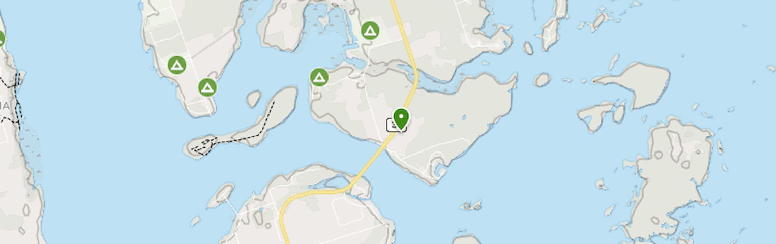
John Earle Chase memorial park
Anchor Bay RoadWant to find the best trails in John Earle Chase Memorial Park for an adventurous hike or a family trip? AllTrails has 3 great hiking trails, biking trails, running trails and more. Enjoy hand-curated trail maps, along with reviews and photos from nature lovers like you.
Ready for your next hike or bike ride? Explore one of 3 easy hiking trails in John Earle Chase Memorial Park that are great for the whole family. Looking for a more strenuous hike? We've got you covered, with trails ranging from 48 to 82 meters in elevation gain. Whatever you have planned for the day, you can find the perfect trail for your next trip to John Earle Chase Memorial Park.
Mississauga River Loop is a 1.6 kilometer lightly trafficked loop trail located near Trent Lakes, Ontario, Canada that features a river and is good for all skill levels. The trail is primarily used for hiking, walking, nature trips, and snowshoeing.
17 lokale anbefaler
Kawartha Highlands Signature Park
2499 Peterborough County Rd 36Mississauga River Loop is a 1.6 kilometer lightly trafficked loop trail located near Trent Lakes, Ontario, Canada that features a river and is good for all skill levels. The trail is primarily used for hiking, walking, nature trips, and snowshoeing.
Golf
Book A Tee Time
Dining
Resort Living
Recreation
Private Events
20 lokale anbefaler
Six Foot Bay Golf
52 Fire Rte 39Golf
Book A Tee Time
Dining
Resort Living
Recreation
Private Events
Buckhorn Riding Academy is an equine facility that offers horse boarding, riding lessons and summer camps in the Kawarthas, fifteen minutes north of Peterborough.
Buckhorn Riding Academy
2185 Buckhorn RdBuckhorn Riding Academy is an equine facility that offers horse boarding, riding lessons and summer camps in the Kawarthas, fifteen minutes north of Peterborough.
Just 25-kilometres northeast of Peterborough you’ll find one of my favourite spots, the Warsaw Caves, touted as the oldest underground jungle gym in Ontario. These caves formed during the end of last ice age, about 12,000 years ago.
You may have heard of the famous “drumlins” that dot the landscape in and around Peterborough. The drumlins are large hills that were formed by the movements of the glaciers thousands of years ago. The Peterborough Museum and Archives sits on top of a drumlin (more on the museum later).
But drumlins are only one of the remarkable topographical features around Peterborough. If you want an all-in-one experience, the Warsaw Caves Conservation Area really shows off the full diversity and artistry of a glacier-carved landscape.
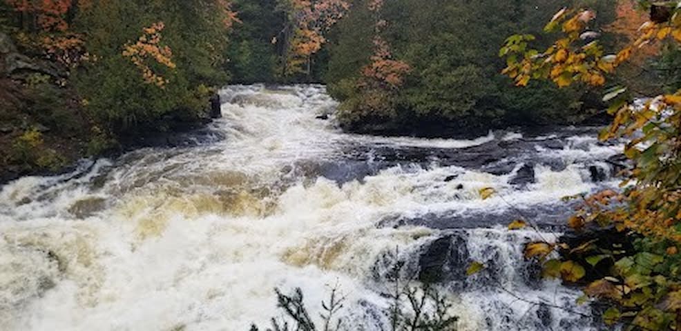
Where the Warsaw Caves are now, there were once waterfalls and rivers that could put Niagara Falls to shame. The result of all that water force over thousands of years is a plethora of stone artistry, from giant caves to small kettles, from picturesque cliffs and ledges to underground streams. There are also many different species of animals and plants that enjoy the conservation area.
This type of landscape, where limestone has been eaten away by water, is called “karst.” Tourists go to great lengths to see the stunning karst landscapes of Austria, Slovenia, France and the Philippines. But this remarkable experience is in your own backyard and it is not to be missed. Make plans in your calendar now to visit.
There are camping options and 15 km of hiking trails that offer some of the most diverse views and landscapes in Ontario. There are so many beautiful spots for hiking that you really can return year after year to explore and find your favourite spot.
Of course, there are also seven caves to explore, several of which have underground, interconnecting passages. Exploring the caves is an activity for “beginners.” Navigating some caves can require squeezing and crawling, while other caves are more accessible and spacious. You can’t get lost since all the caves are fairly compact. There are plenty of fun spaces for the whole family. Be sure to check out the ice cave, where you might find ice even in hot summer weather.
Canoe rentals are available on-site, and paddling on the Indian River is fantastic. The river is beautiful, with shores full of cliffs, trees, beaches and wildlife.
Just remember that having fun requires being prepared, safe and informed. Download the digital brochures, follow the rules, and enjoy yourself.
Warsaw Caves Falls
Just 25-kilometres northeast of Peterborough you’ll find one of my favourite spots, the Warsaw Caves, touted as the oldest underground jungle gym in Ontario. These caves formed during the end of last ice age, about 12,000 years ago.
You may have heard of the famous “drumlins” that dot the landscape in and around Peterborough. The drumlins are large hills that were formed by the movements of the glaciers thousands of years ago. The Peterborough Museum and Archives sits on top of a drumlin (more on the museum later).
But drumlins are only one of the remarkable topographical features around Peterborough. If you want an all-in-one experience, the Warsaw Caves Conservation Area really shows off the full diversity and artistry of a glacier-carved landscape.
Where the Warsaw Caves are now, there were once waterfalls and rivers that could put Niagara Falls to shame. The result of all that water force over thousands of years is a plethora of stone artistry, from giant caves to small kettles, from picturesque cliffs and ledges to underground streams. There are also many different species of animals and plants that enjoy the conservation area.
This type of landscape, where limestone has been eaten away by water, is called “karst.” Tourists go to great lengths to see the stunning karst landscapes of Austria, Slovenia, France and the Philippines. But this remarkable experience is in your own backyard and it is not to be missed. Make plans in your calendar now to visit.
There are camping options and 15 km of hiking trails that offer some of the most diverse views and landscapes in Ontario. There are so many beautiful spots for hiking that you really can return year after year to explore and find your favourite spot.
Of course, there are also seven caves to explore, several of which have underground, interconnecting passages. Exploring the caves is an activity for “beginners.” Navigating some caves can require squeezing and crawling, while other caves are more accessible and spacious. You can’t get lost since all the caves are fairly compact. There are plenty of fun spaces for the whole family. Be sure to check out the ice cave, where you might find ice even in hot summer weather.
Canoe rentals are available on-site, and paddling on the Indian River is fantastic. The river is beautiful, with shores full of cliffs, trees, beaches and wildlife.
Just remember that having fun requires being prepared, safe and informed. Download the digital brochures, follow the rules, and enjoy yourself.
Silent Lake Provincial Park
1589 Silent Lake Park RoadRiverview Park og Zoo
1300 Water StLang Pioneer Village
104 Lang RdAdam & Eve Rocks These glacial rocks are remnants of the last ice age. In geological terms they are known as "Erratics". Similar rocks can be found around the Municipality. These rocks were named by early settlers as The Adam & Eve Rocks. Folklore legend has it, that if two lovers hold hands and each touch one of the rocks, their lives will be blessed. From collection: goo.gl/VaB6rF Buckhorn, Ontario, Canada.
Adam and Eve Road
Adam & Eve RoadAdam & Eve Rocks These glacial rocks are remnants of the last ice age. In geological terms they are known as "Erratics". Similar rocks can be found around the Municipality. These rocks were named by early settlers as The Adam & Eve Rocks. Folklore legend has it, that if two lovers hold hands and each touch one of the rocks, their lives will be blessed. From collection: goo.gl/VaB6rF Buckhorn, Ontario, Canada.
What You'll Like:
Largest known concentration of Indigenous rock carvings (petroglyphs) in Canada, depicting turtles, snakes, birds, humans and more; this sacred site is known as “The Teaching Rocks”
Visit the Learning Place Visitor Centre to discover the traditions of the Ojibway (Nishnaabe) people through the teachings of the medicine wheel
Visit bright blue/green McGinnis Lake – one of only a handful of meromictic (layers of water that don’t intermix) lakes in Canada
Great opportunities for wildlife viewing
109 lokale anbefaler
Petroglyphs Provincial Park
2249 Northeys Bay RoadWhat You'll Like:
Largest known concentration of Indigenous rock carvings (petroglyphs) in Canada, depicting turtles, snakes, birds, humans and more; this sacred site is known as “The Teaching Rocks”
Visit the Learning Place Visitor Centre to discover the traditions of the Ojibway (Nishnaabe) people through the teachings of the medicine wheel
Visit bright blue/green McGinnis Lake – one of only a handful of meromictic (layers of water that don’t intermix) lakes in Canada
Great opportunities for wildlife viewing
Winter Activities
THE BUCKHORN DISTRICT SNOWMOBILE CLUB
The Buckhorn District Snowmobile Club is based in Buckhorn, Ontario, about 25 minutes north of the City of Peterborough. We are a member club of the Ontario Federation of Snowmobile Clubs, and are one of seven clubs making up OFSC District 2.
BDSC volunteers and grooming staff maintain approximately 165 kilometres of trails through varying terrain, from the east shore of Chemong Lake in the south, to the Gooderham area in the north.
The bulk of our trails are in the Municpality of Trent Lakes, in an area of beautiful Canadian Shield forest once known as The Five Points Trail System – a throwback to the earliest days of organized snowmobiling.
To the west, our trails join those of the Twin Mountains Snowmobile Club in the Bobcaygeon area. On the east side of our system our trails connect with those of the Paudash Trail Blazers and the Stoney Lake Snoriders, leading to the Wilberforce and Apsley areas.
6 lokale anbefaler
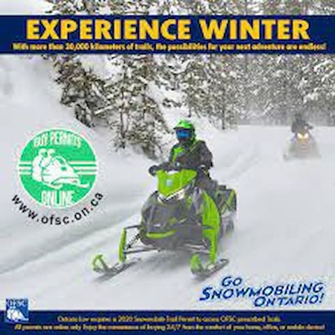
Buckhorn District Snowmobile
THE BUCKHORN DISTRICT SNOWMOBILE CLUB
The Buckhorn District Snowmobile Club is based in Buckhorn, Ontario, about 25 minutes north of the City of Peterborough. We are a member club of the Ontario Federation of Snowmobile Clubs, and are one of seven clubs making up OFSC District 2.
BDSC volunteers and grooming staff maintain approximately 165 kilometres of trails through varying terrain, from the east shore of Chemong Lake in the south, to the Gooderham area in the north.
The bulk of our trails are in the Municpality of Trent Lakes, in an area of beautiful Canadian Shield forest once known as The Five Points Trail System – a throwback to the earliest days of organized snowmobiling.
To the west, our trails join those of the Twin Mountains Snowmobile Club in the Bobcaygeon area. On the east side of our system our trails connect with those of the Paudash Trail Blazers and the Stoney Lake Snoriders, leading to the Wilberforce and Apsley areas.
Kawartha Nordic Ski Club
Nordic Ski LaneEat
Pizza Alloro
5 Main StMainstreet Landing
1939 Lakehurst RdCody Inn Restaurant
1953 Lakehurst RdThe Olde Ice House
1925 Lakehurst RdSix Foot Bay Golf
52 Fire Rte 39
Catalina Bay Resort
17 Fire Route 82BWestwind Inn
37 Fire Rte 21 RdTim Hortons
1420 Mississauga StreetKawartha Country Wines
2452 Peterborough County Rd 36Indoor Activities
The Gallery on the Lake
335 Fire Route 21 RoadThe Canadian Canoe Museum
910 Monaghan Rd