
Atlantic Way Bus
Scenic Drives
The Conor Pass is one of the highest mountain passes in Ireland, and provides the most dramatic and scenic way of crossing from the north to south coast of the Dingle Peninsula. This narrow, twisting road runs for 12kms between the town of Dingle on the south and Kilmore Cross on the north of the peninsula, where roads fork to Cloghane/Brandon or Castlegregory. The views from the road are breathtaking, with a glaciated landscape of mountains, corrie lakes and a broad sweeping valley spread out below
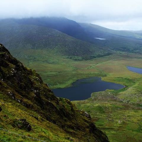
Conor Pass
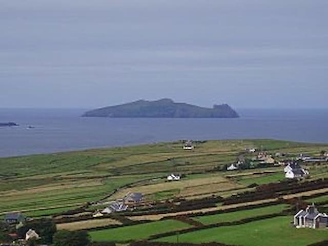
Slea Head Drive, one of Ireland’s most scenic routes, takes you on a journey through historic sites, Irish speaking villages, famous Hollywood film locations with close up views of the world renowned Blasket Islands and distant views of the Skellig Islands on the south western horizon.
The Slea Head Drive (Slí Cheann Sléibhe) is a circular route, forming part of the Wild Atlantic Way, beginning and ending in Dingle, that takes in a large number of attractions and stunning views on the western end of the Dingle Peninsula. The route is clearly labelled by road signs throughout its length. The Slea Head Route is most enjoyable when done slowly over a number of hours or days allowing time for the many interesting stops and detours along the way. A minimum of a half-day should be set aside for the journey.
Travellers are strongly advised to travel clockwise in order to avoid meeting the large tour buses that frequent the route during the summer. Part of the Slea Head cliff road is very narrow and single lane only. The route is suitable for motorists, but is also enjoyed by cyclists - bicycles can be hired at a number of locations in Dingle.
8 lokale anbefaler
Slea Head Drive
Slea Head DriveSlea Head Drive, one of Ireland’s most scenic routes, takes you on a journey through historic sites, Irish speaking villages, famous Hollywood film locations with close up views of the world renowned Blasket Islands and distant views of the Skellig Islands on the south western horizon.
The Slea Head Drive (Slí Cheann Sléibhe) is a circular route, forming part of the Wild Atlantic Way, beginning and ending in Dingle, that takes in a large number of attractions and stunning views on the western end of the Dingle Peninsula. The route is clearly labelled by road signs throughout its length. The Slea Head Route is most enjoyable when done slowly over a number of hours or days allowing time for the many interesting stops and detours along the way. A minimum of a half-day should be set aside for the journey.
Travellers are strongly advised to travel clockwise in order to avoid meeting the large tour buses that frequent the route during the summer. Part of the Slea Head cliff road is very narrow and single lane only. The route is suitable for motorists, but is also enjoyed by cyclists - bicycles can be hired at a number of locations in Dingle.
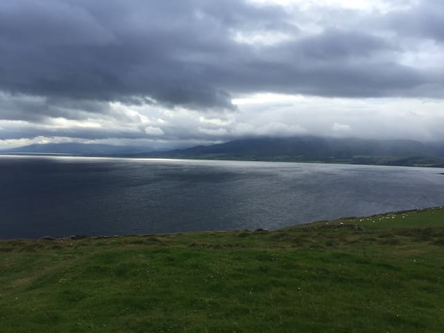
Mount Brandon is the second highest peak after the MacGillycuddy Reeks. Brandon Point is 40km west of Tralee and 20km north of Dingle (via the Conor Pass). You will pass through Cloghane and Brandon villages. There is an observation point with fantastic views at Brandon Point. The car park is right beside the viewing deck so this trip is a great choice for those who can’t manage a lot of walking.
The area is a very popular spot for bird watching, particularly in Autumn. Keep an eye out for whales and dolphin too.
Mount Brandon is named after Saint Brendan “the Navigator”, born in County Kerry in 484. He is said to have left from here on his famous 7 year voyage in search of Hy Brasail, or the ‘Island of the Blessed’. It is believed he travelled to Iceland, Greenland and maybe even America.
7 lokale anbefaler
Brandon Point
Mount Brandon is the second highest peak after the MacGillycuddy Reeks. Brandon Point is 40km west of Tralee and 20km north of Dingle (via the Conor Pass). You will pass through Cloghane and Brandon villages. There is an observation point with fantastic views at Brandon Point. The car park is right beside the viewing deck so this trip is a great choice for those who can’t manage a lot of walking.
The area is a very popular spot for bird watching, particularly in Autumn. Keep an eye out for whales and dolphin too.
Mount Brandon is named after Saint Brendan “the Navigator”, born in County Kerry in 484. He is said to have left from here on his famous 7 year voyage in search of Hy Brasail, or the ‘Island of the Blessed’. It is believed he travelled to Iceland, Greenland and maybe even America.
Sightseeing
Killelton oratory and famine village is just a short walk from Wild Atlantic Bus and we’ll worth a visit.
This is a small stone church or oratory with an earth binding between the stones. Little survive but a narrow west doorway which would originally have been lintelled, and the remains of an east window. It may date from about the 10th or 11th centuries. The roof of the oratory is likely to have been wood as the inner faces of its side walls do not slope inwards as would be necessary for a corbelled stone wall. Excavation showed that the church was built over a habitation site and that the interior was used in recent times for the burial of infants. The area to the south of the church was used for adult burial up to about the middle of the 19th century. The two ruined rectangular structures, one to the west and one to the north of the church,are of more recent date and may be the remains of post medieval houses or byres.Nearby are the remains of a deserted village spread along the line of the old Dingle road.
Killelton Oratory
Killelton oratory and famine village is just a short walk from Wild Atlantic Bus and we’ll worth a visit.
This is a small stone church or oratory with an earth binding between the stones. Little survive but a narrow west doorway which would originally have been lintelled, and the remains of an east window. It may date from about the 10th or 11th centuries. The roof of the oratory is likely to have been wood as the inner faces of its side walls do not slope inwards as would be necessary for a corbelled stone wall. Excavation showed that the church was built over a habitation site and that the interior was used in recent times for the burial of infants. The area to the south of the church was used for adult burial up to about the middle of the 19th century. The two ruined rectangular structures, one to the west and one to the north of the church,are of more recent date and may be the remains of post medieval houses or byres.Nearby are the remains of a deserted village spread along the line of the old Dingle road.
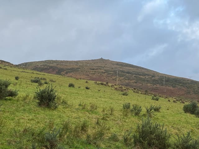
This long distance walking trail ( 176 km /109 mile) is the ultimate way to tour the Dingle Peninsula and can be done as a whole trail in 7 to 8 days or it can be broken into shorter sections which can be easily walked in a day. We recommend you sample at least one short part of this walk while on the Dingle Peninsula and plan to return for a longer version next time you visit!
The circular trail around the Dingle Peninsula starts in the foothills of the Slieve Mish Mountains (Sliabh Mis) on the north east of the Dingle peninsula, crosses to the south shore going west towards Slea Head. From Dunquin and in view of the Blasket Islands the walk meanders north around Mount Brandon, then east along the breathtaking coastal landscape of Brandon Bay and the Maharees back towards Tralee.
Most of the walk is on quiet tarmac roads, mountain, field and cliff paths,with over 20km of beach walking. The route is known for spectacular, varied scenery and passes close to many cultural, archaeological and historical sites.
The Dingle Way is a well-serviced trail, passing through many picturesque villages and Dingle town. With only a few hours walk between villages, food and drink can be bought along the way and accommodation can be booked close to the trail.
For more detailed information about this see The Dingle Way Website
Tonevane Walk Kerry Camino
This long distance walking trail ( 176 km /109 mile) is the ultimate way to tour the Dingle Peninsula and can be done as a whole trail in 7 to 8 days or it can be broken into shorter sections which can be easily walked in a day. We recommend you sample at least one short part of this walk while on the Dingle Peninsula and plan to return for a longer version next time you visit!
The circular trail around the Dingle Peninsula starts in the foothills of the Slieve Mish Mountains (Sliabh Mis) on the north east of the Dingle peninsula, crosses to the south shore going west towards Slea Head. From Dunquin and in view of the Blasket Islands the walk meanders north around Mount Brandon, then east along the breathtaking coastal landscape of Brandon Bay and the Maharees back towards Tralee.
Most of the walk is on quiet tarmac roads, mountain, field and cliff paths,with over 20km of beach walking. The route is known for spectacular, varied scenery and passes close to many cultural, archaeological and historical sites.
The Dingle Way is a well-serviced trail, passing through many picturesque villages and Dingle town. With only a few hours walk between villages, food and drink can be bought along the way and accommodation can be booked close to the trail.
For more detailed information about this see The Dingle Way Website
Food scene
Great coffee in great surroundings. Brilliant coffe and cake shop in Camp open from 8.30am, a great selection of treats with tasty coffee. Cakes, buns, scones, croissants and toasties available with a covered outdoor seating area. The staff are lovely and facilities are super clean. Great place to stop for a chat and view of the sea.
Traditional music every Sunday morning from 11.30am.
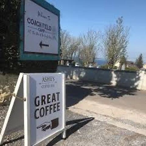
Ashe’s Coffee Bar
Great coffee in great surroundings. Brilliant coffe and cake shop in Camp open from 8.30am, a great selection of treats with tasty coffee. Cakes, buns, scones, croissants and toasties available with a covered outdoor seating area. The staff are lovely and facilities are super clean. Great place to stop for a chat and view of the sea.
Traditional music every Sunday morning from 11.30am.
The Railway Tavern is located in Camp, Tralee, Co.Kerry - 10 miles west of Tralee town on the N86 road to Dingle. A Traditional Irish pub in the heart of the Kingdom of Kerry. Traditional Irish music session every Sunday evening - All musicians welcome.
7 lokale anbefaler
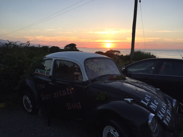
Railway Tavern
The Railway Tavern is located in Camp, Tralee, Co.Kerry - 10 miles west of Tralee town on the N86 road to Dingle. A Traditional Irish pub in the heart of the Kingdom of Kerry. Traditional Irish music session every Sunday evening - All musicians welcome.
Traditional pub. Great ambiance where you’re sure to meet some locals.
11 lokale anbefaler
Ashes Pub, Camp
Traditional pub. Great ambiance where you’re sure to meet some locals.